Travel destinations Peru – Protected areas
Salinas y Aguada Blanca
35 km northeast of Arequipa.
Altitudes from 2800 to 6050 m with an average altitude of 4300 m. The
highest peaks are the volcanoes Misti (5825 m), Chachani (6075 m) and
Pichu Pichu (5664 m).
Extension
366.936 ha.
Climate:
The average annual temperature varies between 2 °C and 8 °C with lows
down to –10 °C and highs up to 15 °C. Rainfall between 200 mm and 519 mm,
often in the months of January to March, less from April to December.
Relative humidity around 50%.
Photo: ANDINA.
2 days / 1 night
Drive from Arequipa through «Pampa Cañahuas», «Sumbay»,
«Vizcachani», «Chukura» and «Parapampa» to «Chivay». Overnight in
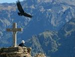
Chivay. Observation of the condors and the Colca Valley from the Cruz
del Condor viewpoint. Return to Arequipa or continue to Puno.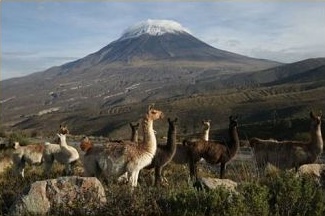 The
aim of the National Reserve is to preserve the natural and landscape
riches of the area, protecting the habitats of animals such as the vicuña,
taruca, Chilean flamingo, Andean flamingo and James flamingo and plants
such as the Polylepis forests (Queñuales). The majestic volcanoes of
Ubinas, Pichupichu, Misti and Chachani in the south-west and the
snow-capped mountains of Chuccura and Huarancante in the north tower over
Andean plateaus dotted with lakes and wetlands. By storing precipitation
as rain, snow and hail, this area becomes an important water reservoir,
especially for the city of Arequipa.
The
aim of the National Reserve is to preserve the natural and landscape
riches of the area, protecting the habitats of animals such as the vicuña,
taruca, Chilean flamingo, Andean flamingo and James flamingo and plants
such as the Polylepis forests (Queñuales). The majestic volcanoes of
Ubinas, Pichupichu, Misti and Chachani in the south-west and the
snow-capped mountains of Chuccura and Huarancante in the north tower over
Andean plateaus dotted with lakes and wetlands. By storing precipitation
as rain, snow and hail, this area becomes an important water reservoir,
especially for the city of Arequipa.
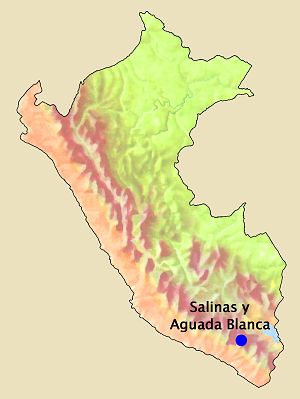 Geographical
location
Geographical
location
Altitude
Travel programs:
PTW-AQP004
Colca valley